
Instrument Expert
Original factory packaging

Service Hotline:
(+86)010-52867771
Instrument Expert
Original factory packaging
Service Hotline:
(+86)010-52867771
Updated:2025-03-13
Views:2534
 WeChat
 QQ
QQ
 Online Service
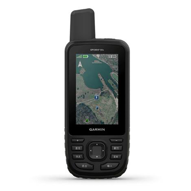
A high-end GPS handheld that can download BirdsEye satellite images
A large color display that can be seen clearly under the sun at 3 inches makes it easier to view.
It supports simultaneous positioning of dual satellite systems, which is superior in harsh environments.
The device downloads BirdsEye satellite images directly.
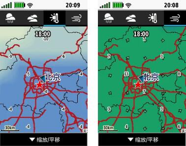
Features a wireless connection that syncs with the phone and updates to show local weather conditions.
Battery life is up to 16 hours in GPS mode; In Adventure mode, the AA battery lasts up to a week, which is more durable than ever.
GPSMAP 66S escorts your every outdoor adventure. Whether you're hiking, hunting, climbing, kayaking, or mountain biking, this rugged, high-end handheld with a 3-inch color display has more to offer. It can help you find your own route by accessing BirdsEye satellite images directly by downloading the device. In addition, it also supports a variety of satellite positioning systems.
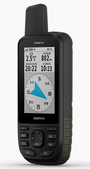
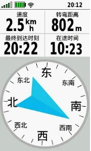
In addition to supporting a variety of satellite positioning systems, the GPSMAP 66 series also has a built-in ABC (altimeter, barometer and triaxial electronic compass) sensor. The altimeter provides altitude data, which can be easily seen. A barometer can predict weather changes by showing short-term trends in pressure. The triaxial electronic compass displays your bearing at all times, whether you are moving or not.
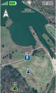
BirdsEye satellite images can be downloaded directly onto the device for a high-resolution, realistic road map to better understand your location. You'll see realistic images of your surroundings, find trails, intersections and open Spaces at campgrounds, choose standing positions for hunting, find parks and parking lots, and even create signposts based on landmarks.
The GPSMAP 66 series device displays weather conditions on the device when paired with a compatible smartphone via Bluetooth. Receive Active Weather updates for real-time forecast information, including temperature, wind, precipitation and cloud forecast maps. It also provides real-time weather radar to make you aware of severe weather that can affect outdoor adventures.
Ready for extreme adventures, the GPSMAP 66 Series offers up to 16 hours of battery life in GPS mode and up to a week in Adventure mode (using 2 AA batteries). With LED flashlight and beacon, can be used to send help signal. The device itself is built to military standard MIL-STD-810G to withstand heat, shock and water, and is compatible with night vision goggles.

Customer Service QQ
Customer Hotline:
Technical Supports


 3003988120
 yiqi.com
 bio-equip.com
 b2bwork.baidu.com
 baidu.com